WEATHER ALERTS
ENVIRONMENT CANADA
*************************
Freezing rain warning in effect for:
• Agawa - Lake Superior Park
• Sault Ste. Marie - St. Joseph Island
• Searchmont - Montreal River Harbour - Batchawana Bay
• Blind River - Thessalon
• Espanola - Killarney
• Kirkland Lake - Englehart
• New Liskeard - Temagami
• Elliot Lake - Ranger Lake
• Chapleau - Missinaibi Lake
• Gogama - Foleyet
• Greater Sudbury and vicinity
Freezing rain overnight to Friday morning.
Precipitation will begin as snow late this afternoon or evening, then change to ice pellets. Ice pellets will change to freezing rain overnight. Freezing rain will continue for several hours before finally changing to rain Friday morning.
This winter weather is associated with a Colorado Low that will track across Northeastern Ontario Friday.
Surfaces such as highways, roads, walkways and parking lots will become icy, slippery and hazardous. Slow down driving in slippery conditions. Watch for taillights ahead and maintain a safe following distance.
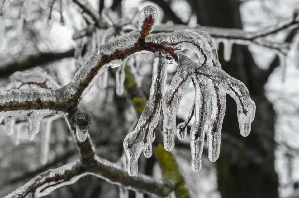
Freezing rain warnings are issued when rain falling in sub-zero temperatures creates ice build-up and icy surfaces.
Please continue to monitor alerts and forecasts issued by Environment Canada. To report severe weather, send an email to ONstorm@canada.ca or tweet reports using #ONStorm.
*************************
Special weather statement in effect for:
• Wawa - Pukaskwa Park
• White River - Dubreuilville
• Little Abitibi - Kesagami Lake
• Timmins - Cochrane - Iroquois Falls
• Fraserdale - Pledger Lake
• Kapuskasing - Hearst - Smooth Rock Falls
Snow beginning this evening changing to ice pellets overnight and to freezing rain Friday morning.
Precipitation will move over Northern Ontario this evening. The precipitation will begin as snow heavy at times before changing to ice pellets overnight then to freezing rain Friday morning.
Snow and ice pellet amounts are forecast to be in a range from 5 to 15 cm by Friday morning. Current indications suggest that a swath from Pukaskwa National Park to Hearst is most likely to receive the heaviest snow and ice pellet amounts.
The precipitation is forecast to change to freezing rain Friday morning and may last for several hours before changing to rain Friday afternoon.
Freezing rain warnings may be required.
Please continue to monitor alerts and forecasts issued by Environment Canada. To report severe weather, send an email to ONstorm@canada.ca or tweet reports using #ONStorm.
*************************
Special weather statement in effect for:
• Manitoulin Island
Snow beginning this afternoon changing to ice pellets or freezing rain this evening.
Precipitation will move over Northeastern Ontario this afternoon. The precipitation is likely to begin as snow before changing to ice pellets this evening. Ice pellets will change to rain or freezing rain overnight.
Snow and ice pellet amounts of a trace to 2 cm are likely. The freezing rain may last for a brief period before temperatures rise above zero early Friday morning.
This winter weather is associated with a Colorado Low that will track across Northeastern Ontario Friday.
Please continue to monitor alerts and forecasts issued by Environment Canada. To report severe weather, send an email to ONstorm@canada.ca or tweet reports using #ONStorm.
*************************