WEATHER ALERT
ENVIRONMENT CANADA
*************************
Snowfall warning issued for:
Wawa - Pukaskwa Park
Agawa - Lake Superior Park
Current details:
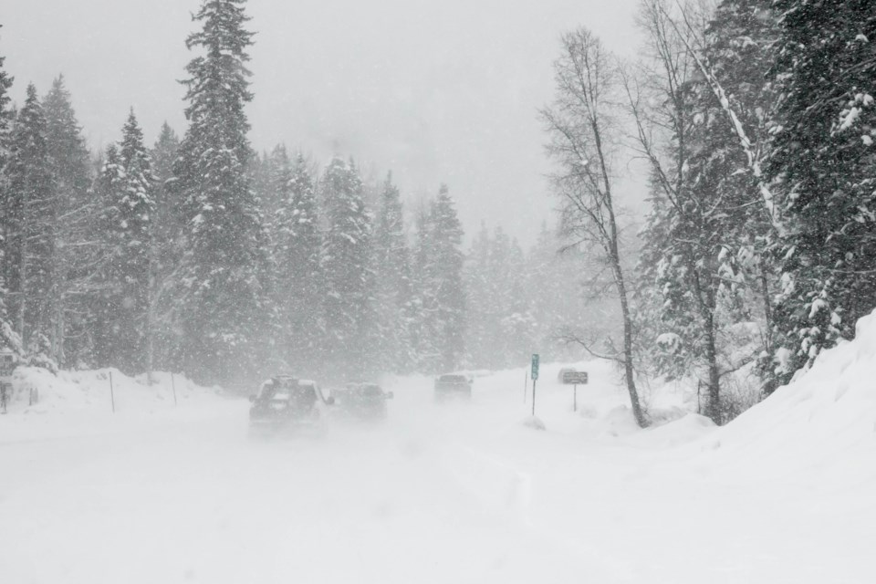
Significant snowfall expected Friday into Friday night.
What:
Total snowfall amounts of 10 to 20 cm.
Reduced visibility in heavy snow.
Difficult travel conditions and possible road closures.
When:
Beginning Friday morning or afternoon, and ending Saturday morning.
Additional information:
Snow is expected to begin affecting northeastern Ontario during the day Friday before intensifying late in the day or Friday evening. Snow will taper off by Saturday morning.
After a brief break Saturday, another winter storm will likely affect the region on Sunday with a threat of significant snowfall, freezing rain and ice pellets. More details on precipitation amounts will come in future updates.
Rapidly accumulating snow could make travel difficult over some locations.
Prepare for quickly changing and deteriorating travel conditions. If visibility is reduced while driving, slow down, watch for tail lights ahead and be prepared to stop.
Please continue to monitor alerts and forecasts issued by Environment Canada. To report severe weather, send an email to ONstorm@ec.gc.ca or post reports on X using #ONStorm.
*************************